The Department of Science and Technology’s (DOST) 3D mapping project called Disaster Risk Assessment, Exposure and Mitigation-Light Ranging and Detection Technology (DREAM-LiDAR) won the prestigious Geospatial World Excellence in Policy Implementation Award for 2014.
DOST Secretary Mario Go Montejo and DREAM program leader Dr. Enrico Paringit received the award on May 8 in Geneva, Switzerland.
A component of the Nationwide Operational Assessment for Hazards (Project NOAH), the DREAM-LiDAR addresses and helps mitigate the effects of flooding disasters in the country. This is doesby collecting precise geospatial data with ?LiDAR? to produce detailed topographic information that will enable the creation of more accurate flood inundation maps. Led by Dr. Eric Paringit, DREAM-LiDAR is by far the biggest single project that a research unit in the entire University of the Philippines system has ever undertaken.
The project’s main deliverable is an accurate national terrain elevation map to be used for creating flood plain indundation maps and for performing on-demand flood simulations. The digital terrain maps willcover all relevant river basins with one-meter horizontal resolution and 20-centimeter vertical accuracy.
The project has purchased three airborne LiDAR scanners and leased three small fixed-wing aircraft to survey 18 large river basins that total more than 100,000 square kilometers in area which is about one-third of the country. The project requires elaborate preparation and training of local staff to carry outvarious technically challenging tasks such as hardware installation, flight planning, LiDAR quality checking, data pre- and post-processing, and flood modeling, among others.
DREAM-LiDAR, considered as a unique role model for the region, offers the opportunity of acquiringequipment, training local staff, and educating the public, as well as adding excitement to many young Filipino researchers.
Creating technical expertise as it is implemented in an educational institution, DREAM-LiDAR is constantly training and self-educating the local staff. Upon completion of the project, it is expected to have created a pool of highly-skilled LiDAR and Flood Mapping experts. These experts can apply theirtechnical knowledge and skills in government agencies and commercial enterprises and get further value from the collected elevation data or innovate for novel 3D applications.
Aside from producing both product and expertise needed to exploit data at a much lower overall cost while also creating new tax-paying high-tech jobs across the Philippines, DREAM-LiDAR also hopes to inspire other nations in charting their own national mapping programs.
The DREAM-LiDAR project is housed at the National Engineering Center of the University of the Philippines Diliman in Quezon City. The project is monitored by DOST's Philippine Council for Industry, Energy and Emerging Technology Research and Development (DOST-PCIEERD).
Meanwhile, the Geospatial World Magazine owned by Geospatial Media and Communications (formerly GIS Development) conferred the award to DREAM. (S&T Media Service)
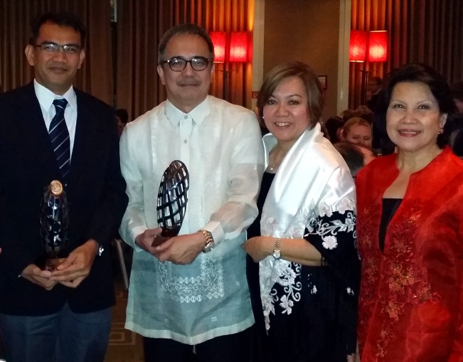
(From left): Dr. Enrico Paringit, Associate Professor at UP Diliman, DREAM Project Leader, and DOST Sec. Mario Montejo received the Geospatial World Excellence in Policy Implementation Award last May 8, 2014 in Geneva, Switzerland. With them are Mrs.Montejo, and Mrs. Cecilia Rebong, Ambassador and Permanent Representative of the Philippines to the United Nations.

